
Digital Surface Model of the Dromborg property.
Color-coded elevation data screen shot. This screen includes powerful online tools to measure elevations, as well as distances, acreage, volume, cut & fill. Our web-based platform generates multiple file types, including: .las .obj and orthographic images.
APAC - Video demo "Sharp's Quarry" 3-Mapping/Modeling
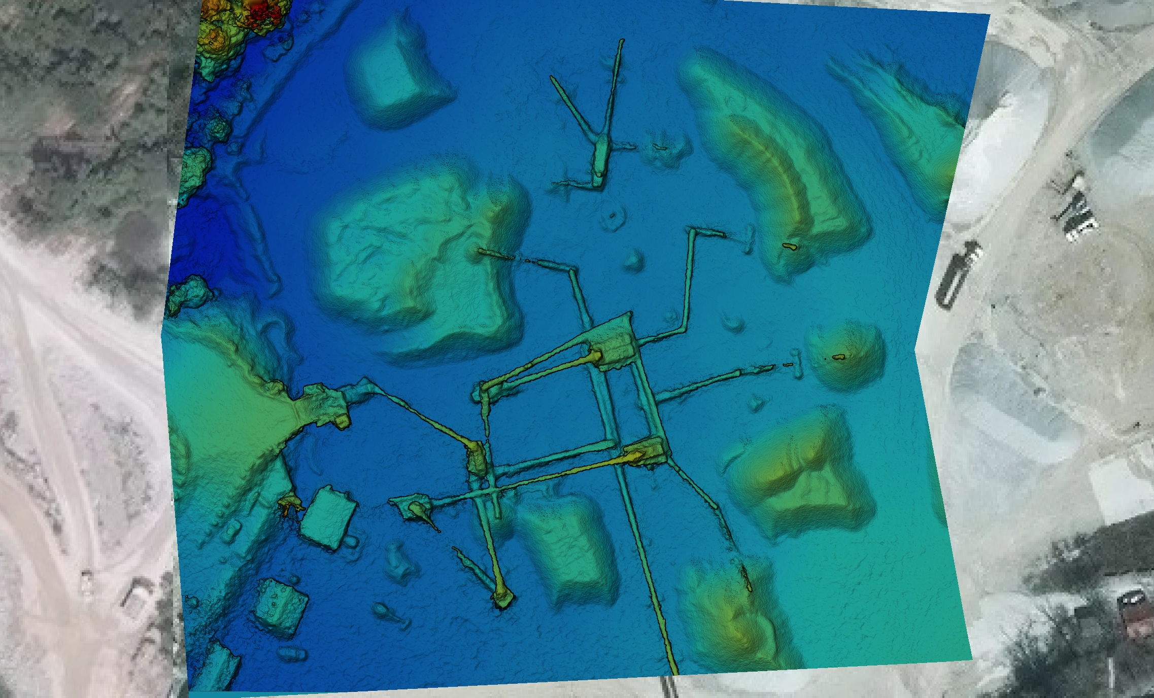
Sharp's Quarry: Digital Surface Model
Color-coded elevation data screen shot. This screen includes powerful online tools to measure elevations, as well as distances, acreage, volume, cut & fill. Our web-based platform generates multiple file types, including: .las .obj and orthographic images.

Test shot: Sharp's Quarry Orthograhic Map - Rendered from 52 separate images
Test shot: 3-D Model of raw building site in Fayetteville, Arkansas

Digital surface model - elevation data for raw land with existing building.

Orthographic map image of same site.